Wednesday, May 10, 2006

Did you hear the one about the lost hikers?


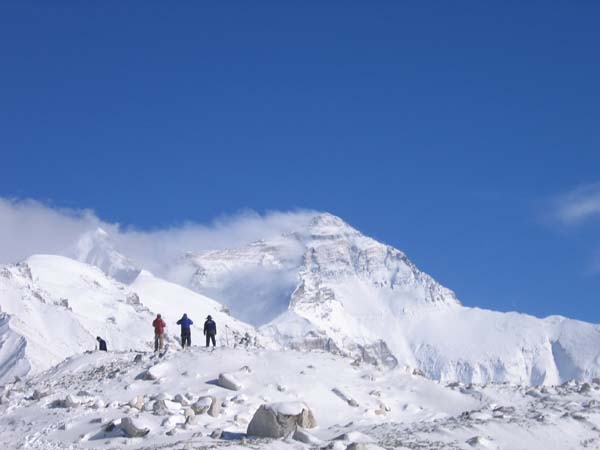
A couple lost in the mountains above my hometown for three nights were found alive Tuesday. They survived by scavenging items from the backpack of a hiker who vanished a year ago. Talk about good luck-bad luck.

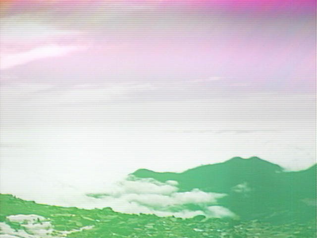
From press reports, it sounds like the two Dallas residents, both in their 20s, rode the Palm Springs Aerial Tramway and set off on the warren of trails that branch out behind the restaurant/tram station. They weren't dressed for hiking, let alone spending the night in the shadow of Mount San Jacinto (10, 804 feet).

In addition to thanking their rescuers, the two paid tribute to John Donovan, 60, who disappeared while hiking in May 2005. His backpack provided the couple with matches, food and heavy clothing.

Donovan was last seen in the San Jacinto Wilderness on May 3, 2005, about two weeks after he retired. A friend believes Donovan got hurt and froze to death in a snowstorm that blew in. The two lost hikers are lucky they didn't get caught in a similar storm. Rescuers found them at about 4,500 feet near Tahquitz Canyon - about 2½ miles from the tram. Overall, they're fine.

I guess it still needs to said - we can't hear it enough! - always be prepared.

Thanks to Gary R. Burzell for use of the great photo. Brings back memories.

(posted by editor Dena)

Go west, young man

Gazette TV writer Andy Wineke and his kayaking pals may be headed to California, Oregon and Washington, where river runners predict a strong and long season, according to The Associated Press.

In Oregon, precipitation has been above average, and the snow pack in April was 36 percent above normal, according to the Natural Resources Conservation Service of the United States Department of Agriculture. Snowpacks also are above or well above average in the southern Cascades of Washington, southern Idaho, a portion of southwest Montana and a portion of northern Colorado.. Streamflow forecasts are also above average in northern Utah, southern and western Wyoming, northern Nevada and the Sierras of California.

(posted by editor Dena; Deb's outta state and Dave's crazy busy.)

On Everest, it's time for a summit push


Hi All,
As of 9 May we have finished our training/acclimatization period here, having hiked and climbed about 100 miles (up and down) between 17,056 ft. (Base Camp/Camp 1) and 24,300 ft. (between Camp 4 and Camp 5). Now, we’ve returned to Base Camp (BC) and will head down to local towns lower down for some rest and relaxation, and the higher oxygen content, before returning to BC on 14 May and beginning to move up the mountain again for summit attempts.

Most of us remaining appear to be generally healthy, with the exception of just about everyone having some sort of cough (due to the dry air and high altitude) of varying intensities. There are also one or two climbers that physically aren’t going to have a shot in any way, shape or form at even getting close to the summit. One man, in particular, sticks out. He’s a good guy and from Colorado, but probably should have left the mountain a week or two ago, but can’t bring himself to admit that he’s done here. While the rest of us have been up to Camp 4 twice already, he hasn’t been able to make it beyond Advanced Base Camp/Camp 3 due to various physical issues.

Coming to try and climb Everest clearly has been a dream of his for a very long time, and he took a second job to earn the money to get here, but in his obsession to try and reach the summit, he’s missing out on the whole point of mountaineering (and life in general) and potentially putting his life in jeopardy by continuing to try and climb when he is not fit to do so. I don’t feel sorry for him, because he’s old enough to have learned (if he can) that it’s the journey, not necessarily the destination, that counts most while cruising down life’s highway. If you aim high, knowing that sometimes you’ll hit low, with your life’s dreams and aspirations, you will inevitably accomplish great things. Summits are great and spectacular achievements, but just a small part of the whole picture, of the journey. He clearly hasn’t learned this yet.

To borrow a quote from the John Candy movie "Cool Runnings," “If you’re not enough without it, you’ll never be enough with it.”

So far, although I’ve reached all my initial goals for this expedition, I could walk away tomorrow without having come one step closer to the summit and be completely satisfied. Not so for my friend from Colorado, and more than a few others here.

“There are no secrets to success. It is the result of preparation, hard work, and learning from failure."
-- Gen. Colin Powell

However, so far I’m still healthy and in the game, but also realistic about my chances of reaching the summit. Of the 15 or so climbers still here hoping to reach the top, 3 or 4 might make it. Such is the difficulty of reaching Mt. Everest, the place on our planet where Heaven and Earth meet (quote borrowed from my friend Tish Stropes). If your only definition of success is the summit, than you’re bound to be disappointed. But what an incredible and glorious goal to strive for.

We’ll be starting back up the mountain from BC around May 15th to make summit attempts.
Stay tuned, David

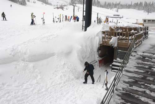
You weren't the only one to get snow


Photo courtesy Aspen Times.
The top of Pikes Peak is as white as a wedding cake. The giraffe cam at the zoo shows the foothills also got a bit of snow, but it's melting fast.

And of course, there's snow in the mountains, where today, backcountry ski legend Lou Dawson is nearing the end of a retracing of the "Trooper Traverse," a backcountry ski route between Camp Hale and Aspen pioneered by the Army's 10th Mountain Division in 1944.

There's a good story about the endeavor in today's Aspen Times, detailing the four-day route, and how Dawson tracked down information from surviving members of the Division. Dawson is doing the ski with David Christie, the son of former 10th Mountain Division trooper Neil Christie, and a few others, but said their trip will be nothing like when the troopers did the 40-mile ski with 80-pound packs and huge, wooden skis.

The skinny on the Pueblo Kayak park


Gazette TV writer Andy Wineke paid his first visit of the season to the Pueblo Whitewater Park Sunday and reported back:

The flows were a little under 600 -- that makes most of the holes on the shallow side, but it's a friendly level for beginners. Or, in my case, for experienced paddlers dipping their blades for the first time of the year.

I'm sad to say there hasn't been anything in the way of amenities added over the winter -- it's still change in your car and pee at the McDonald's across the bridge. There are more trees planted, but it's going to be a long and slow process before Pueblo is anywhere near as inviting as, say, the Golden whitewater park.

As for the rapids -- Number one is still my favorite. It's a biggish breaking wave. Drop in and it's stupid easy to spin all day long. Low-angle cartwheels are possible, but it's a shallow spot. No. 2 is easy and shallow at this level. Strictly spins and low-angle cartwheels here. No. 3 is about the same, with a little better hole on river left. No. 4 has a sweet wave/hole in the middle, but it's very, very hard to paddle into from the eddy. I caught it on the fly and was too tired to get back. No. 5 is a lot like 3. No. 6 about the same.

No. 7 deserves special mention. When the park opened last year, 7 was extremely sticky at almost all water levels. Dangerously sticky at high water. One paddler reported seeing some girls in an inflatable raft taking the beating of their lives in 7 at high water last spring. Even at low water -- like 600 -- you had to paddle out or swim out. If you flipped over, the hole would recirculate you all day. You'd never flush out.

Naturally, that's a bit more excitement than the fine people of Pueblo had in mind when they built a whitewater park, so early this spring, No. 7 was mellowed out by raising No. 8 a foot or two (No. 8 isn't so much a playhole as a wave train that finishes off the course).

I'm happy to report that No. 7 is now a pretty straightforward wave/hole like Nos. 2, 3, 5 and 6. I think the danger is gone, although we'll have to see it at high water.

As for me, despite the long winter's rest, I can still cartwheel to my left, bungle it badly to my right, the handroll is still there and everything else still needs work. Fortunately, the season is just getting started.

Tuesday, May 09, 2006

Admire from a distance


The National Park Service officially banned climbing on named arches and natural bridges in Arches National Park today following a documented climb.

Dean Potter, 34, has photos and video of himself climbing up and rappelling from Delicate Arch - several times - on Sunday morning.

Arches Park Superintendent Laura Joss told The Associated Press she reported Potter’s climb to the Interior Department, and that rangers were investigating possible damage to the arch.

The new rules on climbing are posted on the park’s Web site. (Thanks to the National Park Service for the photo of Delicate Arch.)

“It’s one of the most beautiful things in the world to climb, and because it wasn’t illegal I decided to climb it,” Potter said. He studied the cracks and crevices on the arch for years, looking for a route he could take without climbing aids. He rated it a difficult climb, with some overhangs on the way up.

“I respected nature to the fullest. The most damage I did to the arch was to blow a little dust from the hand and footholds,” he told the AP.

A photographer was once charged with a misdemeanor for setting fires under Delicate Arch (the span displayed on Utah license plates).

(posted by editor Dena)

Monday, May 08, 2006

Climber turns back on Everest

While local resident David Lien is believed to still be acclimating for a summit bid on Everest, The Associated Press reports that a Steamboat Springs man has abandoned his attempt after experiencing chest pain at about 22,000 feet.

Matt Tredway turned back late last week and had returned to Katmandu, Nepal, by the weekend, according to his posting on the Web site of Team No Limits, his climbing group.

Tredway, a teacher at Steamboat Middle School, did not suffer a heart attack or any other heart damage, wife Dana Tredway told the AP.

On the Web site, Matt Tredway said turning back was a “bitter disappointment” but the right decision. Two Sherpa climbers helping Team No Limits were among three Sherpas killed April 21 when ice crashed down on them, the team reported on its Web site.

(posted by editor Dena)

Trip report: The Indian Peaks are still full of snow


I went for one of my first forays into the Indian Peaks west of Boulder this weekend for a little backcountry skiing. I think people from the Springs tend to ignore this range because it's right next to Denver - the trails can be a bit crowded - but let me tell you, with this year's healthy snows, my friends and I had a great ski, and the cool, glaciated peaks I saw already have me planning a return trip.

Some of the mountains there, while not especially high (Long's Peak is the only 14er) have classic alpine routes.
Just looking at Lone Eagle peak gives me the willies -- in a good way. And Mount Toll looked equally fetching.
As for crowded. On a full day ski, we only saw five other people. Not too bad for being an hour outside Denver.

Anyone else poke around the Indian Peaks? What are some favorite destinations?

Photo credit: imagesofcolorado.com

Friday, May 05, 2006

St. Helens "fin" growing


A fin-shaped slab of fresh volcanic rock in the crater at Mount St. Helens National Volcanic Monument is growing about 5 feet a day, The Associated Press reports. (Thanks to the USGS/Cascades Volcano Observatory for the cool photo, which is NOT of the fin, but the 1980 eruption.)

The 300-foot rock is one of seven lobes that have been pushing their way through the surface for about 18 months. You can see them from the Johnston Ridge Observatory, which is open 10 a.m. to 6 p.m. daily through Oct. 20. Or, you can look at photos of the crater and the fin.

Scientists expect over time the volcano will rebuild its conical peak, which blasted apart May 18, 1980.

(posted by editor Dena)

Watch out for the fumes

You try to be a good hiker and take care of your boots, but the smell of that sealant you spray on them is enough to kill a cat.

Actually, it has killed more than one cat. This week, the U.S. Centers for Disease Control and Prevention detailed its investigation into people and pets suffering after using a waterproofing boot spray. Almost 200 people and more than two dozen pets have gotten sick since early last year, and three cats died after exposure.
Most of the cases were linked to two products: Jobsite Heavy Duty Bootmate and Rocky Mountain Boot Weather and Stain Protector. In more than half the cases, the boots were sprayed indoors, but those who sprayed their boots outdoors or in a garage got sick after they brought the boots back inside.

The sprays have been pulled from the shelves, but if you've got some on a shelf somewhere, I'd get rid of it.

Looking for sun, head up Pikes Peak


These are the days in Colorado Springs that are best for a good steep mountain hike. It's murky down here (and cold) but sunny up above. And for me, there is nothing cooler than starting in the murk and climbing up through to the sun. That last layer of cloud almost seems to glow just before you break through.

Right now, the cloud deck seems to be at about 10,000 feet, according to the Pikes Peak Summit cameras. So, any hike above that will get you into the sun. Some favorites: Mount Rosa, Mount Manitou, Barr Trail, or just drive up the Pikes Peak Highway. But bring a sweater. Just 'cause the sun's out, doesn't mean it's warm.
(I can't believe I ended the blog that way. I've now officially become my parents.)

Ditch the mist for snow!

Head to Loveland on Saturday to demo AT boards created by a company in Evergreen. It's free, but make sure you take your driver's license, a credit card and you have a lift ticket.

Storm the park Sunday for Loveland's closing day. There'll be live music and a rail jam at Love Park.

Headed to A-Basin, instead? The 3rd annual Huck, Rock and Roll kicks off at 10 a.m. Saturday (registration $10, includes goody bag - from 8 a.m.) in Mutha' Hucker terrain park. There'll be music on the hill and Underlining Einstein is set to play 1 to 4 p.m. in the base area.

Can't make it to the Basin Saturday? Don't worry, there'll the beach scene surely awaits if stop by Sunday. Just be prepared to share.

(posted by editor Dena)

Thursday, May 04, 2006

Are you sure you're done skiing?


Arapahoe Basin is still holding on, with a respectable 67-inch base. But check this out - Mammoth Mountain in California still has an 11- to 15-foot base. That's feet, folks. The resort plans to stay open until July. (Check out the picture - this deck is usually 20 feet off the ground.)

Victory for the little guy

The little guy can relax, at least for now. The National Park Service won't increase charges for wildlife photographers and other small independent filmmakers within the national parks. A new fee schedule that was supposed to begin this month would have charged filmmakers $150 a day, up from $200 a year. But a spokesman for the Department of the Interior said that rate was designed for big-time filmmakers. The newest policy says the little guys won't have to pay location fees.

Godsend or eyesore?

National Park Service officials are developing a plan to cover new wireless towers, antennas, Internet and radio services in Yellowstone National Park.

Some applaud it as a way to make a park visit easier. Others believe it is an unwanted intrusion. A cellular tower built in the Old Faithful region five years ago drew criticism from advocates of the environment and historic preservation. It was eventually shortened 20 feet from its original 100-foot height so it was less visible.

What do you think about cell phones and national parks? Do you feel unprotected when your phone doesn't work? Are you relieved to be in a place where no one is on the phone? Are you offended by the idea of the phones themselves, or the unattractive towers they require?

Keeping the Ute Mountain Trail Open

The mouth of the Ute Mountain Trail, which leaves from a small lane between the Cog Railway parking lots and a batch of rundown cabins in western Manitou Springs, may be closed when the cabin area is re-developed into condos. At least that's the concern of many Manitoids who love using this historic trail.

Jonathan, one of our readers, e-mailed to say there are public meetings about the development happening, starting today, for anyone who wants to add their two cents.

Here's a schedule from him:

The public comment is scheduled today from 5 to 7 at the property (top of Ruxton Avenue just east of the cog). The planning dept. meeting is May 10. The city council meeting is May 23, I believe.

I would like to encourage anyone who is concerned to stop by one or all of the meetings.
Contact Jonathan for more info: 719-473-8844

Barr Mountain Race almost full


Apparently some of the popularity of the Pikes Peak Ascent is spilling over to the Barr Mountain Race, which happens a month earlier and only goes halfway up the mountain.

At 10 a.m. the race was 65% full (140 spaces left). It may fill up by the end of the week, or even the end of the day, so if you're thinking of giving it a try, either as training for the ascent, or as a less burly alternative, you better move. The race costs $20. 100% of fees go to benefit local nonprofits (can't beat that).

To register, click here.

On Everest: getting the gods drunk and pushing to Camp 4

We have another update from local climber David Lien on Mt. Everest. All seems to be going well:

We’ve completed one of the first major hurdles of this expedition over the last five days by moving up beyond Advanced Base Camp/Camp 3 (20,992 ft.) to Camp 4 (22,960 ft.), high atop the North Col. As I stated in my last update, this is where the suffering would truly begin, and it surely did.

We left Base Camp/Camp 1 for Intermediate Base Camp/Camp 2 on 27 April, spent the night at IBC, then continued on up to Advanced Base Camp/Camp 3 on 28 April. After spending two nights in ABC, we started the most difficult hurdle of our expedition so far: climbing the North Col. up to Camp 4. This camp is located at a point higher than any place in the western hemisphere, where Aconcagua in Argentina tops the highpoint list (22,800 ft.).

Reaching the Col. was one of the major goals I set for myself in joining this expedition. From this point on, every foot of altitude gained will truly be icing on the cake. However, before departing ABC for the North Col., we had to complete our Puja (blessing) ceremony. This was conducted by a Lama from the Rongbuk Monestary, who passed on traditional blessings from the Dali Lama for a safe and successful expedition.

Part of the ceremony included the blessing of our climbing gear, along with lots of food and drink, alcohol included. The alcohol used in the ceremony is intended to get the bad gods drunk, distracting them so that they do not interfere with our expedition. Having gained some firsthand knowledge of beer over the years, I took exception to their use of Budweiser to entice and distract the bad gods. However, it should make them sick at a minimum, and hence less able to pay much attention to us clamoring up Mt. Everest.


The ceremony lasted about two hours, after which our personal Sherpa-guides were ready to lead us op the ominous looking North Col. Most of us have hired personal Sherpas to guide us every step of the way above Advanced Base Camp (ABC), and all of them have been to the summit. From now on, every time we venture above ABC, our Sherpa-guides will be with us, watching over us, carrying the heaviest of our combined climbing gear, and doing everything within their ability to get us to the summit and keep us alive. The strength and stamina of these local Himalayan climbers is truly astounding, as is their capacity for expressing general happiness and generosity while in the midst of very harsh and difficult conditions. We are truly privileged to have them with us.

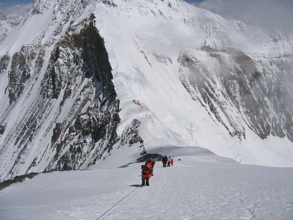
Once we reached the base of the North Col. and clipped into the first of the many fixed lines leading us to the top, and providing a safety “net” should we slip and fall, we spent approximately three physically demanding hours working our way towards the top of the Col.

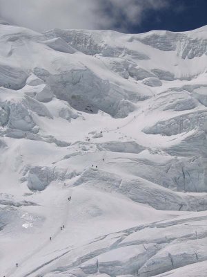
From ABC, the line of climbers ascending the Col. looks like slowly moving ants; up close, like slowly moving people. After topping out on the Col., we still had to cross a laddered crevasse and climb a bit higher to our tents. At Camp 4 we piled into a cramped mess tent for some liquids and food before retiring to three-person tents to get into sleeping bags and warm up. Above ABC, you do not use a personal sleeping bag, but bags that are placed at the camps by the expedition and used by whoever is in camp at the time. So, you never know who has been there before you or how sick they might have been, and what you might catch as a result. This is the way it’s done. The higher up you go, the less each climber can bring individually; the less you want to bring individually. Each step is a struggle, so less is more.

It was only about 7:30 p.m. when we retired to our tents, and we would be in the tents resting and “sleeping” for the next twelve hours. Given that we were now at another new high altitude for the expedition, all of us knew what the night would bring: altitude headaches, delusional-like dreams, and very little sleep. It was one of the longest twelve hours I have ever had to endure, but we will have more such nights ahead, each more intense and uncomfortable than the last as we reach new altitude highs.

After one night at Camp 4 on the Col., we returned to ABC and then all the way down to BC to rest and recover. Next, in a couple days, we will start back up to ABC, then to Camp 4 again (22,960 ft.), then on to Camp 5 (25,256 ft.) for another night of suffering (due to experiencing a new altitude high), then back down to Camp 4 for a night, then down to ABC and back on down to BC to rest and recover again. From BC, we will all choose towns even farther down below BC to visit for several days to get fully rested for summit pushes. Meanwhile, our Sherpas will establish Camp 6 (27,224 ft.). Sometime between May 15th or 20th we will all move back up to ABC and start looking for breaks in the weather. Those of us who are still healthy will attempt to move up to Camp 6 and make summit attempts.

After a night up at Camp 6 and a summit attempt we will have run out of strength and oxygen for a second attempt. So, everything has to work out perfectly. It’s a one shot deal, even after having endured so much just to get to that point. Even if our expedition consisted solely of the world's greatest and most capable mountaineers, it’s possible that not many of them would make the summit. Such is the temperament of Everest. You do not storm her flanks and conquer her summit, you sneak past her, timid and frail, hoping she decides to take pity on the weak and insignificant creatures crawling toward her top. It’s a game of chance, of calculated risks, but life is not without risks, you learn to take them or you stay at home and watch life on television.
Step by step, David

Wednesday, May 03, 2006

Local on Everest, well, almost


Local climber (and bank auditor) David Lien is attempting Mt. Everest from the north side (China). He's sending e-mail updates when he can. Here is the latest:

Hi, All. We arrived in Camp 1/Base Camp (BC-17,056 ft.) on 18 April with dark grey skies above along with falling snow being whipped up by strong wind gusts, and without having yet seen Mount Everest. However, during the evening of our second day in BC the weather started to change. Although I had no knowledge of the local weather forecast, I climbed the snow-covered ridge above camp in hopes of sighting Everest if the system was on its way out. It was.

I watched in awe as the clouds cleared, revealing a monstrous and breathtaking scene: 29,035 ft. Mt. Everest covered with a fresh layer of snow and with a snow plume stretching out for possibly a mile whirling off its summit. The brawl of the wind and snow had given way to a breathless, exhausted peace. To quote Edward Abbey, the mountain glittered under the sun with that harsh perfection characteristic of God’s early work. That single moment has already made this expedition a complete success for me. All the rest will just be icing on the cake.

As described by Matt Dickinson in "The Other Side of Everest": “From the south, Everest is shy and elusive…Crowded as it is, by Nuptse and Lhotse, you have to climb right into the Western Cwm, above Base Camp, before the Southwest Face is truly revealed. Even from Kala Pattar, the famous Everest viewpoint for trekkers, only a frustrating potion of the mountain is visible.”

“From the north, Everest does not hide behind any veil, it reveals itself in all its glory with no preamble or guile. It just sits there alone, proud and magnificent, a pyramid of rock, sculpted by the most power forces on earth over millions of years. No other peak encroaches on it - none would dare. It effortlessly fills what seems to be half of the horizon. The view from where we stood left no room for any doubt at all: This was the ultimate mountain.”

Soon, a few others from camp joined me and we watched the changing panorama in the late afternoon light as though Everest was a physical addiction we couldn’t turn away from. After maybe 30 minutes, the sun dropped below the surrounding mountains, decreasing the temperature by 5-10 degrees almost instantly, and sending us scurrying back down to BC and into our tents. Due to the number of climbers in our expedition, we have divided up into two groups.

On 22 April, our group started the climb from BC/Camp 1 (17,056 ft.) up to Intermediate Base Camp (IBC)/Camp 2 (19,024 ft.) along the Rongbuk Glacier and East Rongbuk Glacier. After spending one night in IBC, we continued up to Advanced Base Camp (ABC)/Camp 3 (20,992 ft.), covering a distance of about 10 miles from BC to ABC. ABC is higher than North America’s highest mountain, Mt. McKinley, and the highest altitude most of us have ever “slept” at, if you can call what we experienced sleep. Sleep is increasingly difficult the higher up you go, for a number of reasons: altitude headaches, loss of appetite/upset stomachs, irregularity (diarrhea), and cold. In the worst cases, cerebral edema (brain swelling) or pulmonary edema (lungs fill with fluid) occur. Several of our expedition members had to be assisted down from either ABC or IBC with the early signs of these two potentially deadly reactions to altitude.

So far, I am doing well overall and have experienced only mild, short-term altitude headaches and overnight upset stomachs. However, the first night at ABC was a difficult one for all of us. At times like that, as you spend entire nights awake, feeling the uncomfortable impacts of the altitude and occasionally making late night dashes for the bathroom (if you can call it that) with bouts of diarrhea, you sometimes questions what you’re doing up so high, so far from home.

Although I climb mountains for many reasons, as JFK said about going to the moon, we do these things not because they are easy, but because they are hard. And I have found that nothing truly good or pure in life comes easy. Aiming high and hard work are prerequisites for living a good and decent life, and for endeavoring to make a difference rather than just existing. As Teddy Roosevelt said, “I have never in my life envied a human being who led an easy life; I have envied a great many people who led difficult lives and led them well.”

Having said all that, we obviously have some very difficult days and weeks ahead. One of our expedition’s climbers, who was also here last year, captured the essence of what lies ahead when he said above IBC/Camp 3, “it’s about the suffering.”

Tomorrow we will leave BC for IBC, then ABC, and after spending two nights there move up to Camp 4 (22,960 ft.). It’s above ABC/Camp 3 where the real “suffering” and danger begins here on the north side of Mt. Everest. After one night of what is certain to be a cold and uncomfortable night at Camp 4, we will descend back down to BC and rest before repeating the entire process again, but moving up through the lower camps faster and then above Camp 4.

My next update should come on Monday or Tuesday, after we return from Camp 4. Step by step, David Edward Abbey: “The high forest has its charms, but I think I love most the timberline regions. The taiga, the tundra, and the tarn. Here the trees are few and scattered, growing close to the earth. The world opens out and one begins to understand what we’re doing here.”

Tuesday, May 02, 2006

Pay to shoot?


Wildlife photographers say it's the end of beautiful pictures of beautiful places. National park officials say it had to be done.

Under a law passed in 2000, the Department of the Interior has to charge location fees for filming on public land. The bill, say park officials, was designed as an impact fee. Photographers now pay $200 a year plus fees for park services or assistance they need. Interim fees to comply to the law would charge them $150 a day for filming in national parks. Filmmakers say the agency is lumping together small independent filmmakers and big commercial production companies, and it's not fair.

The permanent fee structure will be released to the public in a couple of months; the interim fee goes into effect May 15, with a 30-day comment period. For a photographer's take on this new law, check out www.nppa.org/news_and_events/news/2006/04/fees.html