Showing posts with label hiking. Show all posts

Monday, January 14, 2008

Another weekend trail report


Hiked in Red Rock Canyon on Saturday with my mom, who's visiting from the San Diego area. She falls more deeply in love with the park every visit.
Stretches of trail that see a lot of midday sun have some snowmelt and resulting mud, but most of the trails were snow-covered.
Trails that follow roads were the slickest where tires had tread - or hundreds of feet had walked the tread tracks. Walking the ridge between the tracks was easier going.
Remember, even if it's a bit muddy, stay on the trail. Going off trail does not help the trail system.


Areas of the Goddesses/Contemplative trial were slick, too. Yaktraks help. We saw a few people using trekking poles, too, for added balance.
We hiked Red Rock Canyon to Roundup to Goddesses. Gorgeous. With today's sunshine and relative warmth and Wednesday's predicted freeze, however, look out. It could make hikes a bit more treacherous.

A LOT of unleashed dogs running around. All of them friendly to us, but that's not the point. More than one eager pup jumped up, which could have been a problem if we'd been standing on an icy section of trail.
And while I'm on the topic of dogs -- take along waste bags. There was a fair amount of dog poop in the middle of trails. Frozen dog poop is not more aesthetic nor easier to get off your hiking boot than it is in dry conditions.

Friday, September 07, 2007

Summit challenge


(photo from 14ers.org)
If you're new to the 14er lineup, here's what Dave calls an "extra credit" credit climb:

Oh, and beware if you're planning to head out this weekend. Some folks are predicting snow above treeline. Take appropriate gear, and let someone know where you're hiking and when you should return.

Extra Credit: Challenger and Kit Carson peaks

A personal favorite, two great peaks with that offer an astounding amount of exposure. This hike requires airy scrambling and route finding. Additional route information and photos are available at 14ers.com.

TO GET THERE: From the town of Crestone in the San Luis Valley, turn right onto Galena Street. Road climbs into dry, shrubby hills for just over 2 miles. There is a parking area at the National Forest boundary. After that, the road requires an SUV.

THE HIKE: From the trailhead, go a few yards up and take a right across 2 small streams on the Willow Creek Trail. Follow the clear trail 1.25 miles through a series of switchbacks. The trail climbs into the stunning Willow Creek basin and gradually climbs east 2.5 miles to Willow Lakes.

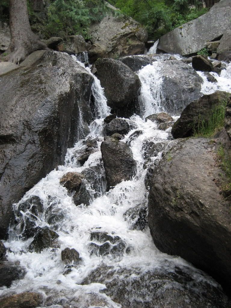
There are many social trails near the lake. From the west end of the lake, the main trail skirts the north side, then climbs up through a talus slope to the top of a prominent waterfall.

Follow Challenger Point - Route #1 to the summit of Challenger.
From Challenger, you can't miss Kit Carson. Hike east down to the saddle (more of a notch) between Challenger and Kit Carson (13,790'). When you reach the saddle, climb up onto a large ledge that runs south along the side of the peak. This Class 2 ledge system that traverses around Kit Carson is often called "Kit Carson Avenue."

Continue up the ledge to reach a small saddle between Kit Carson and a large fin called The Prow. The elevation here is about 13,950'.

From here you can see the next part of the hike - a longer section of KC Avenue that descends east. This ledge is much longer than the one that came up from the Challenger side. Follow this easy ledge down to about 13,700' near its end.

Look left for a large, shallow gully up to the left (northwest). From the ledge, you may see cairns up on the rocks that show the way into the gully before you reach the lower portion of the ledge. From here, it's about 450' to the summit.

Climb onto the rocks to enter the gully. If the terrain seems steep, you may have left the ledge too early. The gully is not difficult or technical if you stay on the standard route near the middle. It requires occasional easy Class 3 scrambling and a bit of route-finding, but mostly it’s just difficult Class 2 hiking.

Look for brief trail sections and small cairns as you take the easiest path up through the center. Near 14,000', the gully opens up and the summit is up to the left. Continue up the gully to reach the north end of the summit ridge (near 14,090') or angle left to hit the ridge closer to the summit.

Once you reach the summit ridge, turn left and hike south to the summit.

Among the 14ers.com notes: You'll need a couple of hours to climb to the Kit Carson summit and return to Challenger. Plan accordingly. Some recommend camping below Willow Lake.

Friday, July 27, 2007

Thomas Trail pix here


Hope this'll work. I'm trying to post from a La Quinta Inn in Albuquerque. I may have to ask my colleagues in the Springs to lend a hand.

This trail above Green Mountain Falls is fun. It's not difficult, and the lower part isn't long, but it isn't flat, either. It's the sort of trail my friends and I would have staked out as kids, playing army or jungle warriors - lots of up and down, rocks and trees, places to set up an ambush.

Take a short hike or run along the bottom stretch or set aside a few hours for the loop. Lunch in the Garden of Eden sounds great right now.

This is a good trail on a hot day - plenty of shade. And be kind to the folks who live near the trailhead and park down below in town. You're out for a hike, so what's it matter to add a few blocks?

What trails do you hike when it's hot out?

Wednesday, July 18, 2007

Out with the Chiweenie

Dave stopped by a bit ago with Stanley, the mighty Chiweenie. They were headed out to hike a Happy Trails for an upcoming Out There section. Stanley's a good hiker.

Deputy news editor Carmen Boles says her Chihuahua, Teacup, is a good hiker too. I saw a Dachshund moving at a good clip at the top of the switchbacks on Barr Trail a week ago. Great hikers come in all shapes and sizes.

Make sure you take plenty of water for yourself and your hiking companions. And if you think of it. send us a photo for the blog.

This happy hiker among the penstemon was resting along the Mount Esther Trail a few weeks ago with Out There friend Zen.

Monday, June 18, 2007

Most popular trail


Limited access and the fact there's no meandering probably make the incline seem more popular than it is. Still, this is Ruxton Ave. on Sunday morning just before 8.


These cars don't belong to cog railway patrons nor Ruxton residents nor folks waiting for the dinner show at the Iron Springs Chateau. These cars ferried people to the incline and Barr Trail.

That's a LOT of people. And dogs.

Did anyone find a place that wasn't packed over the weekend? I'd say summer, which officially arrives Thursday, is here.

Monday, June 11, 2007

Progress at Cheyenne Mtn.


Dropped by Cheyenne Mountain State Park yesterday to hike a few more miles and see how construction is progressing. This top photo is the north end of Blackmer Loop. The trail quickly drops into the trees on the far side of this meadow. Winds and dips among oak and pine.


Definitely looks like camping could open later this summer, as projected. Other facilites are a ways off. But they sure look nice. This is a typical picnic site. Tent sites look similar, with a designated pad for your tent.

The park is still open weekends only. There were crews up there working Sunday. It's worth visiting, but call ahead or check the Web site to make sure it's open.

Rangers/naturalists were packing up a presentation on animals - like the skins and skulls hands-on display we've touted up at Mueller. Only a dozen cars in the lot, but I was told visits were steady all weekend.

We took Coyote Run to Boulder Run to Raccoon Ridge and the start of Acorn Alley back to Boulder and then returned to the lot via Blackmer Loop and Medicine Wheel. Boulder Run lives up to its name - a rocky trail. Blackmer is a beaut and Medicine Wheel looks like it'd be a kick on a mountain bike. It was fun to hike, too. This photo is from the west end of Medicine Wheel, before it becomes more of a singletrack trail.

Next time we'll head out Talon to North and South Talon trails.